Borealis cruised into a night of light rain past the sheltering Hebrides and we could feel the slight waves. We passed the 500 foot cliffs of Cape Wrath, a name derived from the Norse for turning point, and turned our bow to the east, heading for the choppy waters of the Pentland Firth, between Orkney and Scotland. To the West was the wide expanse of the Atlantic Ocean. But we turned north heading towards Kirkwall, Orkney's capital, where we were due to dock for a few hours.
We awoke in the morning to a view of small, green islets, but the view soon changed to Kirkwall harbour, where Borealis dropped anchor. The town was built of small stone houses, and I was reminded of Norway, a country that I have visited. This is unsurprising, for Orkney and Shetland were under Scandinavian rule until the fifteenth century when they passed to Scotland as a dowry payment. Their inhabitants often deny that they are Scots and claim strong affinities to Norway, a situation that displeases Scottish Nationalists. Britain is richer in local identities than maps reveal.
Covid regulations dictated that passengers could only leave the ship in an organised tour, of which there were several options, but some were booked up already and others were not suitable for one with mobility problems, and as I have Parkinson's disease several tours were not possible. We chose a 90 minute coach tour of major features. We confined ourselves to the main island, known as Mainland, but we saw key sites of Orkney and we had an excellent tour guide to conduct us, a farmer's wife, Orkney born and bred, who knew and loved the land.
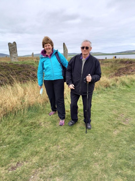
Of particular interest was the Ring of Brodgar, a megalithic stone circle that is part of the rich Neolithic heritage of Orkney. It is a henge, a circular surrounding a ditch enclosing and defining a level area in which a ring of megaliths [ standing stones] stands silently defying millennia. You cannot enter the ring, but walk round it sensing the atmosphere of an abandoned temple once held in awe, but now a prehistoric reminder of a forgotten faith. It was, like Stonehenge, probably a temple to the sun, designed to track the solstices, the markers of the sacred year. I wondered what rituals were enacted there, but the stones were silent.
We toured this fecund isle with its rich sandstone soil enriched with millennia of seaweed, with its barley a-growing [no wheat at that latitude] and cattle and sheep happily grazing. We passed the megalithic tomb of Maes Howe with its corbeled dry stone conical structure that has stood unmoved for millennia. We passed the wide expanse of Scapa Flo, an inland sea at the heart of Orkney where in 1919 the German High Seas Fleet was scuttled and where in 1940 a U boat sent the battleship Royal Oak to a watery grave along with most of her crew.
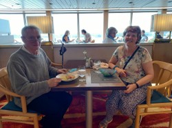
After finishing our brief sample of Orkney we returned to the ship and enjoyed the lounge and later a three course meal. While we relaxed Borealis set sail for Shetland.





 TheThousand Year Gardenon 11/26/2025
 Women of the Gospelson 10/11/2025
 Religious Gardenson 08/25/2025
 Doctor of the Church: John Henry Newmanon 08/03/2025

Comments
The MacDonalds were Lord's of the Isles and had their base on Islay where the clan was at its strongest. Staffa is in the southern part of the Isles.
Yes the growing system used by the MacDonalds is very popular among the Irish.
Thank you!
Might bridge-and-trench, rig-and-furrow agriculture also be practiced among Scots growers?
English Wikipedia seems to suggest MacDonald ties with those scattered Staffa growers of the 18th and 19th centuries.
Rig and furrow is bridge and trench.It is when the soil is piled up in long ridges to make it deeper for crops. You may note that this system is common among Irish growers.
Thank you!
English Wikipedia describes Staffa as 18th-century dwelling place for one family whose members fought to make their niche there permanent. Perhaps their descendants gave up in the 19th century.
That article identifies extant lodgings for 19th-century travelers and indicates "rig and furrow" agricultural legacies.
What is involved in "rig and furrow" agriculture?
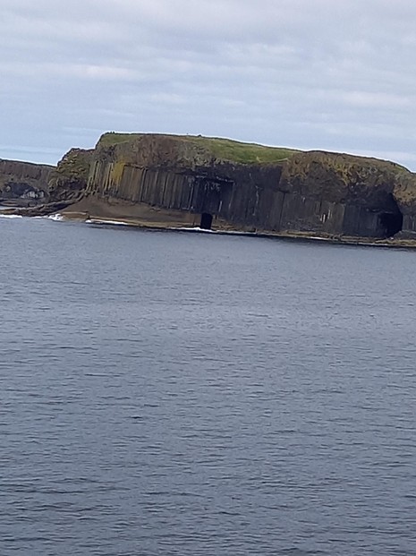
The ship circled Staffa but therevwasvno landing facility, so I could not see the land close up.
The third paragraph to the first subheading, The journey, describes Staffa as uninhabited.
English Wikipedia identifies Staffa as free of livestock since 1997 even as it is home to such bird life as breeding fulmars, puffins and shags and to nesting great skuas and gulls.
Was any such life visible during your passage?
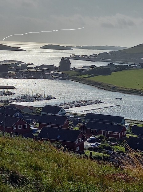
I do not know what it is, maybe a jet trail.
Your wife is a beautiful photographer. All the images look so inviting, with the last one looking additionally intriguing.
What might be that jagged, thick line across the sky in Maureen's Shetland seascape?
I wanted to include a map, but the option is no longer available.
Orkney is an archipelago, as is Shetland. Each is a cluster of islands. Lying between the two archipelagoes is isolated Fair Isle.
Danes and English are ethnically close to each other, but the last bout of Danish settlement in England occurred in the ninth century. Also, both the Angles and the Jutes were Danish, even though in the nineteenth century ancestral territory of the Angles in Denmark was swallowed up by Germany.
My Danish grandmother came to New England directly from Denmark when she was young. That is not to say I couldn’t also have Danish relatives who settled in England. I’m still learning my geography of that area and now I know that Orkney is an island, correct?. I don’t know if Wizzley still has a map section to add to a page, but it might be helpful for this article.