The Remote Islands of Britain

by frankbeswick

The British Isles is a complex archipelago of hundreds of isles of varying sizes, and some are remote and either sparsely inhabited or unoccupied.

If you examine a map of northern Britain you will see the Outer Hebrides. Just west of these isles is St Kilda and as you go north and east in an arc you encounter some very lonely isles indeed, concluding with Fair Isle, Britain's most remote occupied island which is half way between the archipelagos of Orkney and Shetland. All of these isles are difficult of access and battered by stormy seas which cut them off for some of the year. But there are people who accept the challenge of living on some of them.

Photograph of puffin courtesy of Skeeze

Journeying Northwards.

If you were to take a ship and cruise north along the windy, wave-pounded west coast of the Hebrides you would see  a distant peak to the west, which is the island of St Kilda, which was inhabited until 1933 when the inhabitants opted for evacuation. Why it got the name Kilda is not  clear, as its residents called it Hirta, but it may be  a cartographer's mistake. Its impoverished people eked out a living by sheep farming and hunting sea birds on the precipitous cliffs of a neighbouring islet. They had much use for the precious oil of the fulmars that they took. But they only had boats, but no seagoing ships, so they were dependent on regular visits  from the mainland. Before radio their method of communication in emergency was to put a message in a bottle and cast it into the sea, knowing exactly where on the Isle of Lewis it would land. 

For a while in the Victorian and Edwardian periods the residents cashed in on tourism, but there were warning signs. During World War One a German submarine shelled the radio station on the isle. The inhabitants were grateful that he aimed no shots at the village,only shooting at combatants.No villagers were harmed in  the attack. But there was no effective defence on the isle.

But worse was to come. In the years after the war there was a massive plague of infant mortality. No one knew why, though the old Presbyterian minister was convinced that the neonatal care practices of the Kildans, who anointed the newly cut umbilical cord with fulmar oil,  were not to blame, for after all they had worked for generations. But his successor was not so sure and had the oil analysed. The fulmars were infected with typhus and the islanders were killing their own children through ignorance. The practices were reformed, but too late, for a generation had been lost.With the advancing poverty of the 1930s there came economic pressure and in 1933 the islanders succumbed to necessity and were offered homes and jobs on the mainland.

The army use St Kilda now as a communications base. Tourists can still visit it and wander through the ruined village, but they are obliged to take supplies sufficient for a week, as there is a danger of their being cut off. 

Your ship resumes its coasting and soon you pass the uninhabited Flannans, scene of the loss of three lighthouse keepers, but you do not stop there,for you are cruising north towards some of the most lonely isles in the whole of the British Isles. 

Three Lonely Isles

There are some in an arc to the west of Orkney. Two of the three, Sula Sgeir and Sule Skerry are giant rocks jutting fanglike from the ocean, their cliffs adorned with sea birds and white with their guano [droppings. ] But North Rona is an isle that one was inhabited by a tiny  community that was evacuated when it got down to one family. In 1844 the family asked to be moved to crofts [small farms] on the mainland and the landlord concurred. A single family alone on an island is no place for young people to grow up and not a place to grow old. Since then the island has only been occasionally inhabited.Some times fishermen visited and stayed in the abandoned croft houses, and they brought in some furniture to make their stay tolerable. It was a place of refuge in storms.

But  there is a strange and unexplained tale about North Rona. In 1940 a plane crash-landed on the island and so a squad of engineers  was sent to dismantle it and retrieve valuable spare parts. They decided to stay and make their camp in one of the abandoned houses, where they knew there would be furniture and a roof, but on opening the door and entering they momentarily froze and  reached for their weapons. For there, sitting on a chair was a German officer. But he made no move, for he was stone cold dead. There were no wounds on the body. Had a German submarine visited the isle when an officer died? Might it have been the case that  the submarine was later sunk and so the ones who could have resolved the mystery now lie at the bottom of the Atlantic? The British crew buried  the body, but the mystery has never  been solved.  

The island is now a nature reserve known for its sea bird and seal population, but there are no regular human inhabitants. Naturalists and wardens for the Royal Society for the Protection of Birds visit and do surveys. But tourists cannot visit without permission, for it is a site of special scientific interest and a nature reserve. Migrating birds sometime make land there for a rest, so humans need to stand back a little, for we need to make space for other species. 

Foula and Fair Isle

Foula

Look at the map and you will see the last two of Britain's remotest isles. Foula, the more northerly of the two,  is to the west of Shetland while Fair Isle lies between the small archipelagos of Orkney and Shetland and is our remotest inhabited isle  with only thirty seven residents. 

Foula is known for its sea cliffs, which attract a large bird population, and so  it is visited by bird watchers [birders in American parlance.] The folk of the northern isles were all of Norse stock, and Foula, along with the Shetland isle of Unst, were the final redoubts of Norn, the Norse language, and the Lord's Prayer used to be recited in Norn there until the end of the nineteenth century.  The community of about thirty has access to Shetland by a regular boat and a plane service. These provide access to visitors taking the opportunity to see the spectacular Geology and the wildlife of the isle, whose name means bird isle in Norse. 

Three geological features stand out. Da Kame is a precipice twelve hundred feet high which in season is covered with sea birds. Gooda stacks are three pillars which dominate the coast  on the north of the isle. Da Stanes is a storm beach which many consider impressive. There are spectacular sea caves indented deep into the sandstone rock. The word da is old Norn for the. 

The flora of the isle is magnificent. Deprived of modern agriculture with its fertilisers, which destroy wild plants through over rich soil, the isle in season blossoms lushly in floral exuberance. Sea pinks dance in the breeze in company with the introduced but welcome Eurasian visitor, Blue Squill. Wild orchids, no friends of excessive fertiliser join in. On the boggier parts of the isle marsh marigolds, bog cotton, the carniverous sundew and crowberries play their part in the great botanical orchestra. 

And the birds! In a country in which birds are in decline, Foula still has a dawn chorus. Migratory kittiwakes, Arctic terns and red-throated divers have been regular visitors, and rather than just list the rest I will just say the full complement of British seabirds are represented on the isle: guillemots, puffins,skuas and gulls of various kinds to name but a sample. It is a bird watchers' paradise.  

Fair Isle

Fair Isle Landscape
Fair Isle Landscape
sebastian

Fair Isle

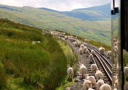
Fair Isle means in Norn the Isle of Sheep, which were the mainstay of what was once an isle with a population of four hundred, now down to thirty seven people who each do a variety of jobs to keep the island viable. Sheep farming is important, though the fleeces now are worth little, and the islanders try to be self-sufficient in vegetables. There was a wind turbine that generated electricity, but it was damaged by a lightning strike and has had to be repaired, though there have been delays in the process and thus expensive diesel oil has had to be used, but even then the power goes off at nights and people have to use oil lamps or candles. At that latitude the winter nights are long and the locals have to fill in their time doing crafts.  

Like Foula the children have to go and board at school at the age of eleven, which puts stresses on family life, and sometimes it is difficult for the children to return for family visits, as the island is sometimes during the winter season cut off for several weeks. So stocking up on supplies is   vital strategy. Access is by a plane or a ferry, which brings in the heavy goods. The National Trust, which owns the island, tries to maintain the community makes housing affordable, but maintaining properties in such a damp climate is difficult. 

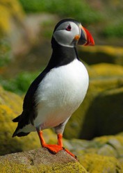
If there is one product that defines Fair Isle it is hand-knitted woollens [hats, jumpers,gloves, scarfs  and socks]  each of which has a pattern. The industry developed in the seventeenth century and provided a good source of income supplying polar expeditions at times. The islanders still spend the Winter nights knitting and sell their products on to visitors from cruise ships, often wealthy Chinese or Americans. 

The future of Britain's loneliest inhabited isle is probably secure, as its people want to maintain their community, but they are trying to attract extra community members, for they know that if there were the loss of three families population decline might be fatal to community survival. A group have formulated an action plan to attract new people. 

One woman is trying to industrialise the process of knitting Fair Isle woollens by introducing commercial knitting machines, but she is meeting resistance on the grounds that the distinct character of the product is that it is hand-knitted. It seems likely that the hand-knitted tradition will survive, but a cheaper , industrially-knitted version might come onto the market, possibly for sale through the on-line-shop that she hopes to open. 

Conclusion

Are Foula and Fair Isle relics of the past or the first steps of a newer world order in the post industrial age when oil has declined? I do not know, and the jury is still out on the matter. What we can say is that communities exist when enough people want them to exist, and that seems to be the case with Foula and Fair Isle, for not only do their members want them to thrive, but there is a fund of good will among the general population that wants communities that are a bit different to flourish. But their population will not be static, for some people will move out and others move in. That's life. 

Updated: 07/05/2018, frankbeswick
 
Thank you! Would you like to post a comment now?
4

Comments

Only logged-in users are allowed to comment. Login
frankbeswick on 07/11/2022

St Kilda is the most common and therefore best understood usage.

DerdriuMarriner on 07/11/2022

You reference, under your first subheading Journeying Northwards, the name Hirta for St. Kilda.

Online sources show different etymologies: Celtic Ei hirt ("dangerous, deathlike"); Gaelic Ì Àrd ("high island"); Irish ler ("west"); Norse Hirðö ("herd island"), hirt ("shepherd") and hirtir ("stags"); and Scots Gaelic hlar-Tir ("westland").

Which would be favored on your side of the (Atlantic) pond by those such as you who would know?

frankbeswick on 10/07/2019

Yes, Derdriu, those are the islets in the St Kilda archipelago where hunting took place.

The bottle was tossed into the sea at Village Bay. The locals knew the tides and currents well and were certain that it would wash up on the beach on the Isle of Lewis.

I am sorry, but I have never heard of the trilogy of which you write.

DerdriuMarriner on 10/07/2019

frankbeswick, Thank you for the photos, practicalities and products.
Are the islands where the people of St. Kilda grazed sheep and hunted seabirds Boreray, Dûn and Soay?
Do we know where on St. Kilda and where on Lewis a bottle respectively could be tossed and washed up? It must come down to precise knowledge of well-kept time and well-behaved water and wind.
In another but related direction, I remember reading about Machair in conjunction with Peter May's Lewis trilogy. What was the series like, and what were the rationale behind, and the reaction to, it being set in a real-filmed community with a made-up name instead of one of the Outer Hebrides' real place names?

Mira on 09/07/2018

This was a fascinating read. Pinned it to my Travel and Nature board.

frankbeswick on 07/06/2018

The Channel Isles are British, but they do not recognize Elizabeth as queen, but as Duchess of Normandy. They are the last remnants of William the Conqueror's ducal domains. They are not part of the UK, but count as crown dependencies, self-governing domestically, but with the UK governing foreign affairs. The Channel Isles are geographically closer to France than Britain.

The Isle of Man came to the crown via the union with Scotland, as the Scottish king became Lord of Man during the Middle Ages. It is a crown dependency.

frankbeswick on 07/06/2018

Surprisingly enough, Fair Isle and Faroe have the same etymology, the far sound denoting sheep.

I agree with your views on the hand-knitting.

Personally, I would not fancy living on a remote isle, especially one where the climate limits horticulture. My wife would detest it. My daughter lives on an island, Anglesey, but it is large and is only half a mile from the mainland at most. Access is by bridge.

blackspanielgallery on 07/06/2018

These must be small compared to the ones I have heard of. I have heard of Jersey, Guernsey, and the Isle of Man. Those are inhabited, and have currency with the queen as baileywick.

dustytoes on 07/06/2018

I never realized how far north these islands are. And talk about a rural life! I can't imagine living cut off from the world amongst only a few families. The Fair Isle knitting done by hand is the draw, in my opinion. Bringing machinery into the mix will diminish the value.
Many years ago, my daughter did a report (in elementary school) on the Faroe Islands, and she I wanted to move there because it was so beautiful. (Maybe an idea for another article?)

You might also like

Explore The Thames Foreshore - Find Hidden Treasure

Coming to London? Why not visit the Thames foreshore and discover the fragme...

Some Scenic Areas in Northern Ireland

Northern Ireland, with its hills and loughs, is an attractive place well wort...


Disclosure: This page generates income for authors based on affiliate relationships with our partners, including Amazon, Google and others.
Loading ...
Error!