Traces of the Past. Oft overlooked signs of farming in the Landscape

by frankbeswick

Agricultural activity leaves traces in the land, which observant people can understand.

Britain is a land shaped over the centuries by farming. The first traces are discernible to archeologists in Stone Age deposits, but some traces of agricultural activity from Mediaeval times can easily be spotted. Often we fail to notice what we see and bypass it on our perambulations. But being able to walk through a landscape and understand what you see, however insignificant, enables walkers to travel in an educated, mindful way and adds to the enjoyment of a country walk.

Epping Forest in Autumn [Fall] with what appears to be a woodbank, courtesy of Etre_P

Up the Hill for Water

Jack and Jill went up the hill

To fetch a pail of water.

Jack fell down and broke his crown

And Jill came tumbling after

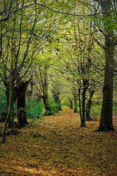
Why? You usually find water in  valley bottoms. Is this just a  nonsense rhyme? No! The rhyme almost certainly originates in the chalk hills of Southern England.. At places in this area we find the phenomenon of dry valleys, which originated in the last years of the ice age, but have no stream running through them, as the extremely porous chalk allows water to sink through it with ease.  But why the upper slopes of these uplands? The answer is what are known as dew ponds. Not all dewponds are on hills, but many are on upper slopes to catch dew and fog droplets that condense on higher places.. Dewponds probably were first  constructed in the Neolithic Age, 4200 to 1900 BC. Neolithic Britons could not manage the dense woodlands  of the country and so preferred the more expansive chalk uplands of the south Downs, the Chilterns and Salisbury Plain, and the oolitic limestone of the Cotswold hills. But these had porous soils. The solution to the problem of water storage was to create large, shallow basins, waterproofed with puddled clay to store water.  

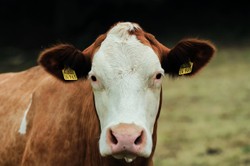
These ponds were not a source of water suitable for arable farming, which is water-intensive, but they could easily serve as watering holes for cattle in a pastoral economy. But surprisingly dew was probably not the source of the water, as scientists have tested them and found that very little dew is collected in them. But the ponds could serve well as reservoirs for rainwater storage. They could also be more aptly named dew or fog ponds. While dew is air-borne moisture which condenses out of the air, fog is already condensed water droplets that settles from the air much more easily than dew does. 

The dew ponds fell out of use in the twentieth century. In 1937 a dewpond builder died and his son wrote to clients promising that the family business of constructing dewponds, which the family had been conducting for two hundred and fifty one years, would continue. But then came the Second World War, and agriculture was affected by the urgent rush to modernize to survive. The dew pond is now a relic.   

Chalk Hills

Chalk Hills
Chalk Hills
Neil Morrell, courtesy of Pixabay

Marl Pits

Two young boys, who have been sent to the library by their mother with the strict injunction to stay away from the grubby pond that they would pass on the way back home, would ever divert from their route home and adventure round the stagnant pond. The elder of the two would take the lead. We went  round the mucky pool hanging from branches as we went, but  neither of us ever fell in, and mother never got to know. I always wondered why the pond had no source of water and no streamlet flowing from it.  But in later years I came to the conclusion that it was not a natural pond at all, but a redundant marl pit.  The marl pit was in a patch of woodland known as Hatchet Woods, a name that has nought to do with the local legend of the mad axman who stalked the woods at an unspecified time in the past and far more to do with the ancient British term Y Chet, the woodland. The wood is now an industrial estate, so small boys who went adventuring in the other ponds in the woods have no more frogs and newts to catch. 

Marl is found in a belt extending from near the Scottish borders down through the west of England to parts of southern Britain. It is a softish rock composed of carboniferous limestone fragments churned up by water and consequently mixed with ancient clay particles. It breaks easily  under the impact of farm tools and is a great and natural soil enhancer full of nutrients. The pits were dug from late Saxon times until the nineteenth century, when different sources of fertilizer, such as South American guano, bird dung, took over. The marl pits were deep, often deep enough for an  exit ramp to enable carts to be hauled out. They also provided a source of employment for some rough and tough characters who would appoint one of their number ,generally six, as Lord of the Pit, and he would lead the men in cajoling tips from passers by, and then he would lead them to the alehouse.    Digging a six foot deep pit was thirsty business.

Holloways

The word holloway is best known as the name of a women's prison in London. But no, we were not in the habit of incarcerating women in great numbers, for the prison's name is taken from a local feature found mainly in England. Holloways still exist and are officially paths, but they are minor relics of an ancient road system. How old they are, no one knows. But they are a type of what is known as a green lane, an ancient path running through a rural district. But not all green lanes are Holloways.

Holloways are formed by the interaction between running water, soft soil and human and animal footfall over many generations. You do not find them on the hard granite of Dartmoor, but they are more common on the chalk and limestone of Southern England, they are known in Northern England and in areas where the bedrock is sandstone. I imagine that a Holloway began when someone walked a path and others followed the route. The land surface was slightly eroded. Soon the rains came and washed away some earth, and the path deepened. Trees soon adorned the sides of the path, but the way was kept open by traffic. Farm carts with their metal tyred wheels continued to wear out the soil.The way became a passage for occasional flood waters; and so the process .went on. Some holloways have reached depths of thirty five feet.

These paths are unsuitable now for all but foot traffic.Trees lining them sometimes yield to erosion and tumble down the sides. A blocked Holloway soon becomes a haven for bramble which quickly tangles the pathway. They are not part of the road system so there is no onus on landowners to maintain them. They can be a danger to unwary walkers and animals. Unleashed dogs have at times slipped into them, and in snowy conditions they can cause a very deep drift to develop.

But to walk down a tunnel of root-encrusted walls in a perpetual twilight of trees is to experience a time gone by. There is something Tolkienesque about them. Overgrown holloways are havens for wildlife. Foxes make their Earths there, wrens flit in the tangle, and birds nest in the tree branches.. Eldritch places indeed!

Wood Banks.

It was in Epping Forest when I first came upon the remains of a wood bank. The forest is 5900 acres donated by Queen Victoria to the citizens of London for recreation. I was seventeen and taking a day off college for a country walk. On the map  I had identified an earthwork and thinking that I would find a fort I strode through the oak, beech  and hornbeam  of the forest to find the relics of quite a small structure. A large square of land surrounded by an earthen bank about three feet high was the sum total of this archaeological site, but archaeological sites are rarely spectacular. But what you find out from background reading adds to the interest. It was a woodbank, a small enclosure dating from the Mediaeval period, a relic of the farming of that period.  

Woodbanks enclosed assarts. In the Mediaeval period forest was land for royal hunting, but monarchs were willing to get some cash by leasing tracts of forest land for agricultural purposes. These were known as assarts. But forests are difficult areas to map out, so there had to be means of delineating ownership of forest land. Fences were apt to be destroyed by hunting activities or wild animals such as deer. Hedges were easier  and more secure, but a hedge can be strengthened by being based upon a low earthwork. On top of this three foot high enclosure would be a wattle fence or dead hedge. This is an interweaving of pliable cuttings that make it hard for animals to pass.through. Pigs could be fed in the enclosure by letting them root in the ground, and cattle could also be safely contained. Occasionaĺy the bank could be planted with trees, which were then pollarded to keep them to a manageable size.   Pollarding is severing the crown of the tree at ten to twelve feet and aĺlowing regrowth, which produces lots of usable wood.

I did find a useful purpose for the woodbank. I used the earthen enclosure as a seat for having my sandwiches and a can of beer. Our mediaeval forebears would have fully approved.

Reflections.

Paid link

Farming moves with the flow of time,  as technology evolves and new demands are placed on farmers. Sadly,not all change is necessary or good. But old ways leave their mark in the landscape. I have referred to some of them in this article. . Old ways might still have uses.It is better that they be not forgotten.


I am an Amazon associate and earn money from qualifying purchases on this page.

British countryside

Paid link
Devon and Cornwall

View on Amazon

Updated: 05/29/2023, frankbeswick
 
Thank you! Would you like to post a comment now?
23

Comments

Only logged-in users are allowed to comment. Login
frankbeswick on 06/08/2023

Wood bank is the only term that I know to describe what is a minor landscape feature.Sorry. I do not think that there is another term.

DerdriuMarriner on 06/07/2023

The first paragraph to your fourth subheading, Wood Banks, describes "A large square of land surrounded by an earthen bank about three feet high" as a woodbank.

That does not seem to me the term that west-ponders use even as I find its meaning, spelling and use clear.

Would there be any synonyms, and would you by any chance know what word west-ponders use?

frankbeswick on 06/07/2023

It would be legally treasure trove, a legal status given to gold and silver discovered in the ground. The judge who makes the decision on this matter determines whether it was deliberately abandoned or whether the owner had concealed it with the intention of recovery .if the latter is true it either goes back to the owner or if the owner is long dead with no heirs the state takes the treasure but pays the finder and the landowner the value of the treasure as identified by a suitably qualified assessor.

DerdriuMarriner on 06/07/2023

Thank you!

That's interesting about Balmoral Castle. Some online source -- may have been authoritative, may not, because how can west pond-siders compete with east pond-siders ultimately for accuracy of all things British Isles?;-D -- mentioned Balmoral Castle as the favorite place for royal family members to stay. Might there be an indication somewhere how much Queen Victoria paid (and might she have gotten a royal discount ;-D?)?

Regarding the high tide mark inland, King John might have lost much of the royal treasure in the Wash, according to west-pond sources. Without royal ownership of beaches from high tide mark inland, would it be finders-keepers if someone found that treasure or would it no matter what just automatically go to its last true owners, the royal family?

frankbeswick on 06/07/2023

Good question. The monarch acts on the advice of the prime minister, but if it is not a parliamentary issue she can act on the advice of the privy council, the monarch's council. Victoria would have authorised the Crown Estate , which manages the monarch's properties, to legally organize the transfer. Victoria's transfer would have to come through the Crown Estate because she owned the forest in virtue of her role as monarch. This is different from her ownership of Balmoral Castle, which she bought in a private capacity.

All forests in Britain and many beaches down from the high tide mark belong to the Crown.

DerdriuMarriner on 06/06/2023

The first paragraph to your next-to-last subheading, Wood banks, references Queen Victoria donating Epping Forest for Londoner recreation.

Would she have made that decision on her own? And would there have been some economic or political advantage to her doing so?

frankbeswick on 06/04/2023

No offencevwasvtaken. Boys do things thatbtheybshuddervaboutbin later years.

DerdriuMarriner on 06/03/2023

I hope that my comments did not sound chiding.

But it's unsettling to think of you and your brother -- like children like to do -- swinging from branch to branch.

Those long, low, straightly outward branches look safely swingable. But they may be what arborists call dog legs. Arborists here think that the term suggests a branch that looks sturdy but that may break quite disastrously.

Two years ago I was walking under a dog leg that somehow caught my hair. It went crashing down when I reached up to untangle my hair from a twig.

frankbeswick on 06/02/2023

My youngest brother got up to worse. But we all survived.

frankbeswick on 06/02/2023

Of course Derdriu, you are right. But boys will be boys, and we get up to things that make us flinch in later life. I have done alsorts of exploits that make me shudder now! I did not identify the trees. I would have got very wet had I fallen in.But the more mature me would not have been so daring. However, I am now 72.


You might also like

The Granite Kingdom: a Cornish Journey

Author Tim Hennigan explores his Cornish identity by walking an original rout...

The Wreck of the SS Politician

The film Whisky Galore is a hilarious comedy, the truth is more prosaic


Disclosure: This page generates income for authors based on affiliate relationships with our partners, including Amazon, Google and others.
Loading ...
Error!