Walking the Length of Britain

by frankbeswick

The John O'Groats to Land's End walk is one of Britain's great challenges

Britain has a peculiar shape, in the South it is several hundred miles wide, but the full length from Land's End at the south western tip of Cornwall to the northern tip of Scotland is about eight hundred miles, and some hardy souls walk the whole distance. Some walk by the direct route along roads, but others with more time like to wander by the scenic paths. The route contains a variety of landscapes, and some of the walking can be difficult underfoot. At times the weather in our rainy and windy island can make life demanding, but it is considered a great journey.

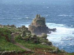
Land's End. Image courtesy of mariepaul, creative commons

The Beginning

Doctor Barbara Moore, who walked from John O' Groats to Land's End in 23 days in 1960 is hardly now cited as the ideal walker. She believed in ultra-fitness and thought that if you exercise,and abstain from smoking,alcohol,overeating and intercourse, you can live to be two hundred.Actually,she reached seventy nine, so  I have no intention of trying out her recipes for longevity, but she was one of the many who have taken this challenging route over many years. Most others who have tried the walk, which was first done in 1879, have availed themselves of the many places of refreshment en route, which include the Tan Hill inn in Swaledale,Northern  England, which has the status as England's highest public house [bar] and is set on the bleak Pennine moorlands. Apparently,no hiker has been known to pass this place without stopping. Well, you would want to stop in a civilized place after traversing those lonely moors. Once you have experienced wilderness you appreciate civilization all the more.

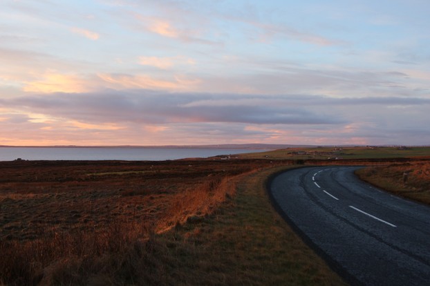
There is a variety of routes, but purists always begin at Duncansby  Head in North East Scotland, before walking eight miles to John O'Groats, a place named after a Dutchman said to have lived there hundreds of years ago. They then take the lowland way along the east coast of Scotland, which is long, often windy and rainy at times. But there is the wide expanse of the North Sea on your left and the distant mountains of the highlands on your right, with their swirling mists and ever-changing cloudscapes. This is a quiet and peaceful part of the walk and seems to be one taken by most walkers, as the highlands make hard and challenging walking that could soak up time and energy that will be needed for the long journey south.

The fastest route is down the east coast of Scotland and Northern England, before turning south westwards towards your destination, but I have just been reading Walking With Plato, by a thoughtful literary buff who mixes accounts of his walking with philosophical thoughts. He and his partner had plenty of time so they turned south westward at Inverness to follow the Great Glen, which contains three lochs, including Loch Ness and the scenic Caledonian Canal with its complex system of locks, before they turned south at Fort William to follow the beautiful West Highland Way and thence across the lonely Southern Uplands of Scotland until they reached the stark landscapes of the Pennines as they crossed the English and Scottish border.   

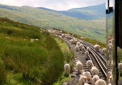
John Hillaby took the inland route through Scotland, traversing the sparsely inhabited lands of the Northern Highlands.He chose to avoid roads where possible, taking tracks and footpaths camping out at nights, often alone, for you are entitled to camp on open land in Scotland. 


The Road South
Scotland
Scotland
AaronPictures

The Pennine Way

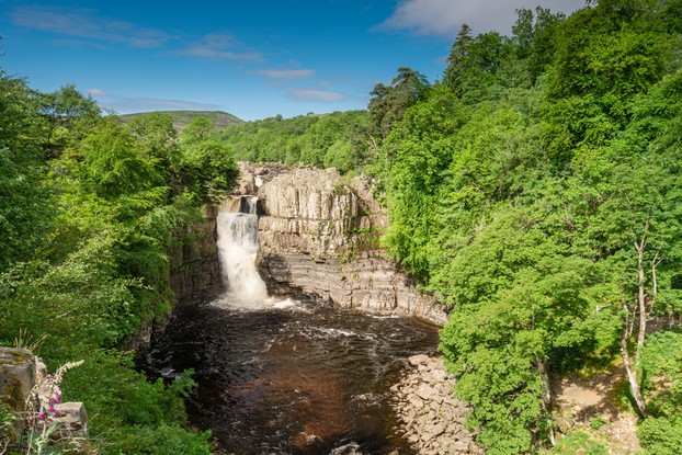
Gary Hayden, writer of Walking with Plato, took the Pennine Way, which for most walkers is a journey in itself. Most of the John O' Groats to Land's End walkers steer well clear of its physically demanding  terrain and sudden swirls of mist. The Pennines are the backbone of England,a ridge of mountains whose heart is carboniferous limestone, but whose edges are Millstone grit; and they run from the Scottish  border into the English Midlands, where the range fades into the pleasant Staffordshire Moorlands.  In the Pennines  the  weather change is swift,  and mists can suddenly descend on you, leaving you disorientated and lost. The track is not always as good as it might be, as the peaty surface is known to degrade under footfall, leaving it  squelchy underfoot. But it is a paradoxical place; you hate it when you are walking the route, but you love it when you have finished.

They stayed at old mill towns,  stone-built places that seemed to grow out of local rocks, relics of England's cotton and woollen industry.  Gary and Wendy moved southwards, gingerly across the bleak moorlands, eventually reaching Bronte country at Haworth. This is the bleak moorland in which the Brontes' novels were set, where Heathclffe and Cathy carried on their tortured relationship.You can still see the house which was the inspiration for Wuthering Heights, it is now a tumbled ruin, but it retains a powerful character.

The Pennine Way is arduous, and at times its bleakness and ability to confuse overwhelm the walker. If you want a speed walk  don't take this path, take the low road through the gentle Yorkshire countryside, but if you have time for a challenge, follow the Pennine route.  

The Pennines

High Force Waterfall
drhfoto

As England spreads out south of the Pennines,your route becomes a matter of choice. Hayden plunged southwards through England, following roads and paths, past cottages and farms, through villages and towns, feeling at home in the civilized England celebrated by poets, a cultivated land familiar to humans and comfortable with and for them. Hayden loved his experience, and he and Wendy, his partner, stopped off at quiet guest houses and English inns, some of venerable age. By this time they had abandoned camping in favour of guest houses and inns, as their need for comfort grew exponentially.

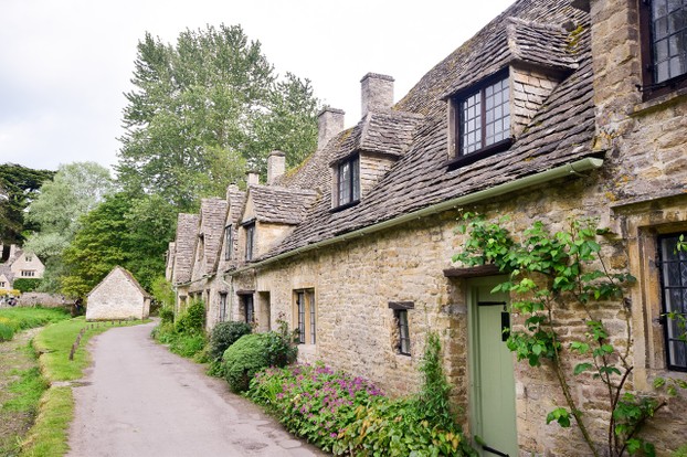
Eventually they met the Cotswold Way, which winds its beautiful path along the crest of this range of hills, unique for its narrow valleys filled with charming villages, all in the warm, rich brown of the native oolitic limestone of which the range is composed. The walk rises and falls in steep ascents and descents, through the sudden surprises of combes [valleys] that come upon you after a steep walk up a hill through fields of sheep,oilseed rape and winter barley that compose much of he agriculture here. 

As with all of southern England,it is a land familiar to humans. There are many mansions of the rich and famous here, and the present prime minister, David Cameron, has his opulent residence in the region. [I don't know how long he will survive as prime  minister, hopefully not long, but that's my view! ] The route finishes at Bath, an ancient spa town since Roman times whose Roman baths were rediscovered about thirty years ago and now are available at a price for those who want to sample the benisons of Sul Minerva, the goddess linked to the spring.

Yet the Scottish walking writer, Hamish Brown, chose  different route, as he eschewed roads for paths and chose as far as possible wild places,so he opted for a path that took him through the mountains of Wales. To do this he diverted just south of the Pennines, long before the Cotswolds and began to walk down the spine of Wales.  Hamish admitted something that he knew was difficult for his fellow Scots to stomach, that the best walking country in Britain is found in Wales. His route took him along the Welsh hills, through the lonely heart of Elenydd, sometimes known as the Green Desert of Wales, as it is a sparsely populated land of reservoirs, sheep farms, moorlands and forests, before he came to the Severn Bridge that took him back to England and the last stage of his journey.   


A Cotswold Village
A Cotswold Village
idunlop

The Final Stretch

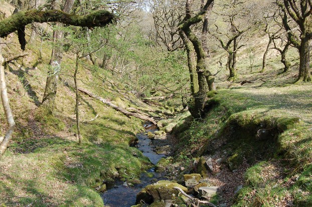
Once back in England the route swings southwest towards Devon and Cornwall. Again there is a variety of routes. You can take the North Coast with its range of tourist towns,  where there will be plenty of places to stay and eat. The South Coast is beautifully scenic and as well equipped with facilities. Or you can go inland, sometimes crossing the bleak moorlands of Dartmoor, Exmoor and Bodmin Moor before you get to the coast. John Hillaby took the moorland route and struggled with bogs and mists, once becoming disorientated in a Dartmoor mist and finishing up alone and having to extract himself from the dangerous marsh of Cranmere Pool. He survived and continued his route northwards, for he began at the southern end.

The coastal path takes you along the Cornish shore, a place of cliffs and crashing Atlantic waves interspersed by small coves and seaside town. It is a county rich in tourist sites.Eventually the walker will reach Land's End. a promontory of hard rock projecting into the ocean. The walk is over. It is a moment of mixed emotions, there is the satisfaction of a challenge successfully won, but the deflation  that comes with knowing that normality must take over again.I have done done parts of the walk at times, but my commitment to my garden means that I will never have the time to complete it.

Exmoor Woodland

Exmoor Woodland
Exmoor Woodland
inkpot
Updated: 06/12/2016, frankbeswick
 
Thank you! Would you like to post a comment now?
20

Comments

Only logged-in users are allowed to comment. Login
frankbeswick on 05/15/2024

I cannot think of a better placebtonstop on that bleak moor.

DerdriuMarriner on 05/14/2024

Thank you for your comment below in answer to my previous observation and question.

Perhaps that first walker in 1879 also set the custom then of stopping at Tan Hill inn?!

frankbeswick on 05/14/2024

Yes It dates from the eighteenth century.

DerdriuMarriner on 05/13/2024

Thank you for your comment below in answer to my previous-day observation and question.

The first paragraph in the first subheading, The beginning, considers that "Most others who have tried the walk, which was first done in 1879, have availed themselves of the many places of refreshment en route, which include the Tan Hill inn in Swaledale,Northern England, which has the status as England's highest public house [bar] and is set on the bleak Pennine moorlands. Apparently,no hiker has been known to pass this place without stopping."

Was the Tan Hill inn in existence at the time of that first walk in 1879?

frankbeswick on 05/12/2024

I don't know who was first.

DerdriuMarriner on 05/11/2024

Thank you for your comment below in answer to my previous, same-day observation and question.

The first paragraph in the first subheading, The beginning, advises us that "Most others who have tried the walk, which was first done in 1879."

Do we know who did that first walk?

frankbeswick on 06/16/2016

I enjoy the Cornish coastal path most of all those areas that I have walked. I would like to walk the Northern Highlands of Scotland, which I have never visited, they are such a long distance away.

I think that because Scotland is so grand a place with many of the most challenging walks in Britain,many think it the best walking country, but Hamish Brown thought that Wales had more greenery, more woodlands than his native Scotland. In any comparison of Scotland and Wales England is not an issue, for the Welsh and Scots are not English.

DerdriuMarriner on 06/16/2016

frankbeswick, Thank you for the hike! What is the stretch that you most appreciate and what stretch do you most -- of what you haven't done -- do you wish to do if your garden and right leg cooperate?
Also, why is it that Scots would not like hearing Hamish's description of Wales as having the best walking spaces? Does part of it have to do with sympathy for Macbeth as a Scots-defending descendant of Kenneth MacAlpine versus successor Malcolm's English way? Perhaps Fleance, if he really existed, took the high roads of the Pennine Way and got to Wales, from his father Banquo's death-place, before any pursuers along low coastal roads.
Isn't it interesting what areas inspire repeated walks? Organic Life magazine has a one-page article on the first woman known to have hiked the Appalachian Trail -- a 67-year-old from Ohio in 1955!

frankbeswick on 06/13/2016

One problem that John Merrill had when he walked the whole coast of Britain is that the stress on his bones caused him to suffer a stress fracture in his foot that led to his taking a month to recuperate. So long distance walkers have to think about having footwear suitable for the distance that they are traveling.

frankbeswick on 06/13/2016

It was once an ambition of mine to do this walk but even in retirement I am very busy. and cannot spare the time, and let's face it, my right leg is not as good as it was. I have walked in several of the areas on the trail, but I have yet to visit the far north of Scotland.


You might also like

Explore The Thames Foreshore - Find Hidden Treasure

Coming to London? Why not visit the Thames foreshore and discover the fragme...

From tor to shore

A new rewilding project is trying to join up some Cornish nature reserves int...


Disclosure: This page generates income for authors based on affiliate relationships with our partners, including Amazon, Google and others.
Loading ...
Error!