The name Long Mynd [Long Mountain] is a linguistic oddity, being a combination of English and Welsh, but its name reflects the ambiguous linguistic and racial inheritance of Western England, neither purely Anglo-Saxon nor Welsh. Mountain might be the wrong word for a flat summit that never reaches more than roughly 1600 feet above sea level, but it is a place with open vistas and great views. Composed of ancient Pre-Cambrian rock, it was an already old when the dinosaurs roamed the Earth. As with all old rock it is heavily leached and not good for farming, so much of it is a grouse moor used for shooting at certain times of the year. Do not confuse it with Long Mountain, which is further west in Wales.

Walking the Long Mynd
by frankbeswick
This outcrop of ancient rock in Western England makes fine walking territory.
Shropshire
The Long Mynd lies along the A49, the road that takes you down from North West England to the South West, in the county of Shropshire, part of the West Midlands. While I was already familiar with the place from my studies of Geology, I had always had the young man's urge to tackle hard rock and rugged summits, so I neglected this peaceful moorland. But taking my young family down to a holiday in South West England, there it was, and I decided that the Mynd was a walking destination for me some time in the future.Maybe I was growing up and maturing as a walker.
There are several ways up the hill, but I like to begin at Little Stretton, a village off the A49. Nearby is the town of Church Stretton. The prefix Stret reveals the history of the place, showing that the A49 runs on the course of an old Roman road, a street,and both settlements, along with All Stretton, line the route of the old Roman way. My favourite route is ascending Ashes Hollow, a narrow V shaped valley carved since the Ice Age into the ancient rock. The route is open at first, passing through a field used as a camp site, and then ascending the increasingly narrow heather and bracken-filled valley. You follow the stream, and it is along this little-used path that you can stop and listen to the individual music of each tiny waterfall along the stream. Barely a few feet high, each has its own music, a pattern of notes that repeats itself time and time again. Alone on the path you can sit and meditate, listening to the individual notes.The last time I went I stopped at each tiny cascade, simply to listen, my mind emptied of anything but the watery notes. I suppose that you can do this anywhere that there is a stream, but the emptiness and quietness of the ancient landscape allowed me to focus and immerse myself in the experience. When I was challenging my young body with rock climbs, I missed this beautiful nature experience, and I regret that I was unaware of the beauty that is found by sitting silently and listening.
As you ascend, you pass through an area of thick heather, or it was thick when I last went. As with all grouse moors there is a pattern and sequence of heather burning. This is a management practice that ensures a regular supply of heather shoots for the young grouse to eat. While the young heather is edible, the old heather is a place of safety. As I walked with my son, Matthew, we heard the grouse churring in the heather, spotted the tiny whinchat, not long back from migration, darting timidly from plant to plant, and espied the menacing hawk on its predatory patrol above us.
Summit
Once you reach the summit you soon reach the Burway.This path, now obviously metalled, runs the route of an ancient stone age track, used by drovers over many centuries as they brought cattle from Wales to the markets of England. First there is the Portway, which ascends from the West, and then the Burway, which takes you along the summit and dips down into England. What strikes you first is the view. You look over the rugged hills of Caer Caradoc to the East. Caer Caradoc means Caradoc's Castle. It is on one of these hills that there are the remains of the earthwork fortress where the Celtic king Caractacus [Caradoc] made his last stand against Rome. Don't imagine Celtic solidarity and Britons weeping at the loss of their leader, it was Rome's ally, the Brigantean queen Cartimandua, paid by Rome to sort out her British compatriot, who took the fortress and handed him over to his enemies. The ancient Britons hated each other, hatred which gave Rome the opportunity to take over in the first place.
The summit is peaceful, though like all heather moors somewhat bleak. It is a good place to sit and eat lunch. The last time I visited I enjoyed the company of friendly horse riders, young women who exchanged pleasantries as they passed. England is like this. Walkers and other country users greet each other as they pass. The gliders from the nearby gliding school on the Mynd pass over you, and you can relish their soaring free above you. The countryside is for all.
Sitting on the Burway in the Autumn mist you feel a sense of time. You are sitting where stone age people sat to eat meat, and there is the sense that you are part of something greater, a great stream of humanity stretching from the past into the future. You imagine the herds of sheep and cattle as the drovers walked through the mist down to the midland shires of England; and you are aware that there will be people on this track when you are gone.
Long Mynd
 | Photo Jigsaw Puzzle of View at dusk over Carding Mill Valley and Long Mynd towards Church Stretto... Photo Puzzle showing View at dusk over Carding Mill Valley and Long Mynd towards Church Stretton,. View at dusk over Carding Mill Valley and Long Mynd towards Church Stretton, S... |
Over to the West
My route takes me to the West across the Burway. There is a spring near the summit called the Boiling Well, probably because it bubbled sometimes. For the ancient Britons springs and mountain tops were liminal places, the edges where worlds meet, and this was a hill top spring, and for them these places were sacred or magical. The ancient pagan Britons would certainly have worshipped here, appeasing the spirit of the hill to ensure safe passage.They may have ascended to seek the benisons of the spirit/deity of the well, which would have invariably been a female spirit.
As you cross the Burway and drop downwards to the West you pass a lonely cottage. When I first started to walk this route the house was abandoned, and I said to my daughter Helen that it would be a good place for a smallholding. She read my mind, "No Daddy, I'd miss Abbey and Lucy." This is the girl who announced that she would never marry a man who liked walking or live in the country. So she married a man who liked walking and lives now on the countryside edge.The house has been renovated by someone with the same ideas as I had and now looks very attractive.
The view is lovely. As the hillside begins to dip westwards you look into genuinely rural England.The rich green of the fields contrasts with the starkness of the Mynd's summit. The distant hills of Wales enchant the eye, and set the background for the nearby hill of Stiperstones. One winter walk just before Christmas I crossed Mynd and set out for Stiperstones. But to no avail. The snow was coming heavily and horizontally, driven straight into my face. I could hardly see a thing, so I had to turn round.
The route swings back over the hill and after re-ascending you encounter the Burway, which takes you along the upper slopes of Carding Mill valley. You can see down into the carding mills preserved by the National Trust. But a key viewpoint is the Devil's mouth, which is where the road narrows above a cwm. At this point it cuts through an earthwork, which is not well preserved. But here you can get views over the South Shropshire hills, looking to the distant Wrekin, an ancient and now extinct volcanic cone.
The Burway
picture by David Evans
 Panoramic Bur | 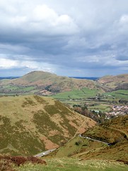 Carding Mill Valley |
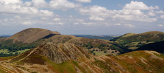 Burway Hill - Shropshire | 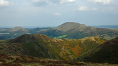 Shropshire Hills |
Shropshire
 | A Shropshire Lad (Dover Thrift Editions) Authoritative edition of one of the enduring classics of English poetry — 63 poems on the nature of friendship, the passing of youth, the vanity of dreams, other human concerns.... |
Warning: the Mynd in Winter
There are places on the Mynd that are not safe to drive in icy conditions, and they are hardly safer for walkers. Shropshire is a eighty or more miles south of where I live in North West England, and some expect it to be warmer than my area is. Well, it is in summer. But the county is in the shadow of the Welsh hills, which cut it off from the warming effects of the North Atlantic Drift. Whereas I am thirty miles from the sea and separated by a flat plain, the Long Mynd is about seventy miles and separated from the sea by mountains. Thus in in winter the climate is colder than areas further north, but in summer it is warmer.
I will step back in time to my winter walk so long ago. I was kitted up perfectly for winter walking, only my eyes visible, and I hiked the moorland road through a snow storm and loved it. The young farmer whom I met looked at me with the pity one feels for a madman, one crossing the moor alone in snow when sane folk were indoors. But I was sticking assiduously to the road and taking no risks. I was loving it. I passed Devil's mouth with no difficulty and a song in my heart, but then the road turned to descend to the safety of Church Stretton. The ice coated the road surface, and on my left was the slope into Carding Mill Valley. I was in potential leg break conditions. Solution. Stick to the opposite side of the road, stay off the stony and slippery surface and walk on the grass and heather. I descended with no injury, but Iater discovered that that stretch of the Burway is lethal in ice. An unsuspecting driver, whose story was recounted on national television, once had a near miss when his car was left hanging over the steep slope into the valley. He and his wife were rescued uninjured and the car saved. It seems that this stretch is dangerous in icy conditions. If you want to walk the Mynd in winter, heed this warning.
Reflections.
One summer evening we walked from Church Stretton to the parked car as the sun was setting in the West and the evening was throwing its last light over the darkening eastern slopes. Two curlews drifted past us as they aimed for their roosts. The walk had been good and the children were tired and happy. Fingers were blue stained from picking bilberry on the moor. Wild food, guaranteed fresh. They would sleep the hundred miles home in the back of the car.
There are lands more spectacular, but the Mynd has character, drawing you from lowland England to a moorland summit in about sixteen hundred feet and then allowing you to survey some beautiful vistas. But it is not wilderness, as it is a hill where English people recreate themselves; walkers, cyclists, riders and gliders all can find something to do in this landscape. You walk on some of Britain's most ancient rock along one of Britain's most ancient trackways. Go in mindfulness.
You might also like
Explore The Thames Foreshore - Find Hidden TreasureComing to London? Why not visit the Thames foreshore and discover the fragme...
Touring North WalesNorth Wales is a beautiful land steeped in history and myth. It is a land wit...




 Doctor of the Church: John Henry Newmanon 08/03/2025
 Restoring the Palm Houseon 07/16/2025
 Pilgrimage. A reviewon 06/15/2025


Comments
There is little room for another paper in Britain, butntherevare plentiful Welsh media outlets and even television and radio outlets.
Thank you!
English Wikipedia indicates that there's no such thing as a daily all-Welsh newspaper. It lists Y Byd ("the world") as an attempt that never made it because of insufficient funding.
And yet it mentions Welsh-language magazines and radio and television stations.
Might the Welsh-language media mentioned above be just balancing their books, making profits or struggling?
Yes, but mainly in West Wales, where the Welsh language is stronger.
Thank you!
Welsh culture has such a literary and musical heritage. It makes me think that it might be possible to be 100 percent bilingual in English and in Welsh in Wales.
Would there be Welsh who are bilingual but who in their private lives at least speak only in Welsh?
I think that Welsh is not spoken in Shropshire or in any part of East Wales as a first language.
Thank you!
It seems to me that Welsh culture suggests local and regional speech patterns.
Were that to be true, would it mean that Shropshire Welsh has been lost or just severely depleted in number of native speakers?
The economic power of languages of the dominant culture squeezes out or pushes back the languages of less powerful cultures. So Welsh was pushed back from Shropshire.
Thank you!
What accounts for the Welsh language no longer being heard or spoken in the border regions?
They would be current place names, but Welsh is not spoken in the border regions now.
Wikipedia describes under its etymology section for the article Long Mynd the names Mynydd Hir and Cefn Hirfynydd as modern Welsh names.
It equates Mynydd Hir with "long mountain" and Cefn Hirfynydd with "long mountain ridge" in English.
Would the above Welsh be what "locals" and Welsh-savvy visitors such as you and your family know as current names?